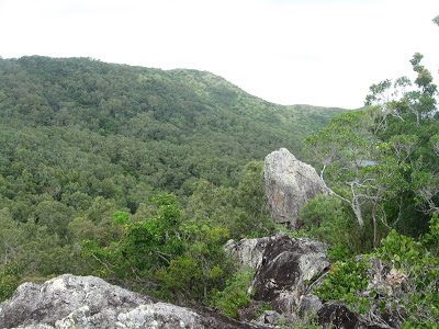
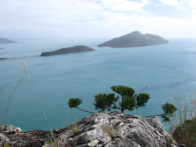
View south
View from Spion kop rock
A superb island with history - a family grazed sheep then it was sold and a resort was built.
Great, easy walks. Excellent coral when the water is clear. Cheap nat park campsite. All within 15 minutes by water taxi from Shute Harbour. Or 1hr by kayak.
Very relaxing place.
BEST BUSH WALK - The ‘Spion Kop’ walk on South Molle Island is voted #1 by Australian Geographic for Queensland’s best bush walk
History of South Molle Island
Around 10,000 years ago, at the end of the last ice age, glaciers melted and the Coral Sea rose over the coastal plain, leaving only mountain-tops and ridges exposed as the rocky Whitsunday islands we see today.
The Whitsundays are the traditional home of the Ngaro Aboriginal people. Archaeological research shows that the Ngaro inhabited the Whitsundays, including South Molle island, for at least the past 9,000 years. The evidence includes stone axes and cutting tools found in a stone quarry on South Molle island, numerous fish traps (stone structures made for catching fish) throughout the Whitsundays, and cave paintings. Two Ngaro caves have been found on South Molle island, but only a handful of people in the world know the exact location.
Ngaro men were skilled navigators. European seafarers reported seeing Aboriginal people paddling from Double Cone island to South Molle island, a distance of 21km. Their canoes were made of sturdy three-piece bark capable of journeys on the open sea. The Ngaro Sea Trails are still being used as commercial routes.
Ngaro women collected vegetables, seeds and fruits, and prepared them for cooking and eating.
A great variety of tools, utensils and weapons were used for fishing, hunting, gathering plants and cooking. The most effective and simple tools were broken pieces of rock used for cutting, crushing grains and as axe heads. Other tools included animal teeth and twists of bark.
A quarry of these Aboriginal people on South Molle island can be seen when walking the Spion Kop track.


No comments:
Post a Comment