Van Nat park Campsite at Island Bend, 1300m
Guthega Trig Base camp
Sunset from base camp Guthega Trig.
Click on the pic above to get a slideshow.
Big screen by clicking bottom right square. Spent the winter season of 2018 in kosciuszko NP, 3 hrs south of Canberra.
with High plateaus and ridges at 2000m altitude, It has a large area of easy backcountry skiing/ Nordic skiing.
Worked for a month or so In Perisher ski resort, one of the biggest in Aus along with Thredbo, driving the shuttle buses between 2 areas in the resort. Plenty of blizzard driving and very busy road on weekends, with cars parked on both sides of the road.
One icy weekend on snow camping in July (minus 10 at night) , with crusty icy snow which required skins at all times.
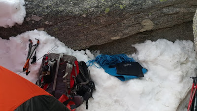
Then For a few weeks in September, when the snow was softer and temps more reasonable. Culminated in 5 days snow camping at 1900m, just below Guthega trig point, opposite Guthega resort (part of Perisher). Which gave me many options for day touring along the 15km ridge line or to Mt Tate etc .
Also managed to get some solo Ice bouldering in ... just went out at night with crampons and ice axes and bouldered up the snow cornices around camp. The snow starts to freeze late afternoon as temps drop.
This was my longest snow camp, and I was well equipped , with small solar panel to recharge my phone daily, kindle reader on my phone to read books, 4 season tent with tough and simple design (RAB Latok Mountain 2) . Snow shovel , good MSR windburner stove which has a valve that adjusts gas output for altitude , cold etc. Thus giving a full burn at any altitude.
This was vital to melt snow every day, usually evening, to make water supplies. And fill my MSR bladder with hot water to use as a hot water bottle in my sleeping bag, then as water supply in the morning.
I also had a recent addition - a Garmin GPSmap64s , which is a waterproof GPS with a screen that shows your position on a map , complete with 40m contours, peaks, roads, even small tracks marked. I turned this on whenever I went on a day trip from the tent, and it tracked my course with a thick pink line. At any time , I could select "Trackback" and it would guide me with a thin line showing my actual position, next to the thick one, enabling me to follow back the track I took originally. Back to base camp.
I used this for 2 hours or so when I a thick fog rolled in one afternoon and it was hard to see any landmarks. It can also be used ay night.
I also carry a PLB (Personal Locator Beacon), for emergencies.


1 comment:
Wow Nice, Tent house in the snow, I want to feel this felling
Post a Comment