Tuesday, September 10, 2019

Kosciusko Winter 2019 X-Country , Downhill skiing.


(Click on a photo for large view)


Guthega area


Looking towards Blue Lake


Snow Gum


Island Bend camp area after big snowfall


Next to blue lake, up from Illawong hut. 


 Island Bend camp area 
 Old settlers hut near Jindabyne picnic area


 To give instant heat, Mr Buddy heater. 


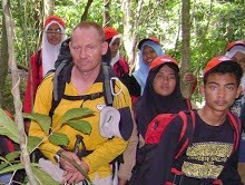
 Walking from skitube towards Thredbo diggings camp area. 


 Lake Jindabyne
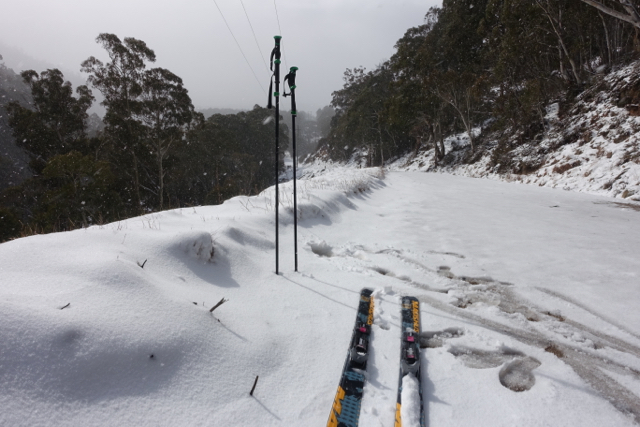
 Alpine Touring skis I borrowed.  Very good on downhill


 Dead Horse gap 
 View of kosi range from victorian side


 Little house in the prairie (Keeble's hut).  Free entry. 


Had  all of August to enjoy Kosiusko NP.  A luxury... this time no shuttle bus driving which could get quite tiring, especially weekends.  
A good break from my job building trails in the Grampians, which can be a bit bleak in the winter.  
Tried a bit of snowboarding (limited success),  did some X country on icy terrain mostly.  Realised September is a better season for x country - less windy, less cold, snow is less icy on the high plateau.

Linked up with Pierre who I had met on queen's birthday,  and did a backcountry tour to Ramshead with his Alpine Touring (AT) skis.  Heavier skis and boots than my Nordic skis.  Basically regular wide skis with a binding that converts to freeheel for flat and uphill.  Need to put skins on for the latter. 
They turned out great on the downhill... great sense of mastery with the rigid boots etc. 
Another day,  we did 5000m total in Thredbo ski resort, using the lifts, and I got pretty much private tuition for my downhill parallel skiing, and improved a lot.  
This also meant I shared some evenings and dinner , which broke my isolation to some degree. 

It occurred to me during the trip that It might have been less spartan to go to Bali... also that for Mountaineering,  I'd be better off flying to Europe and using a place like "La Berarde" or Chamonix as a base camp... easy to find climbing partners,  gentle weather,  a network of mountain huts etc.  
There was a degree of loneliness with living out of the van in spartan cold, which I had not expected. 

The photos were taken with a new camera, good for nightshots,  which I can use for timelapses later: 
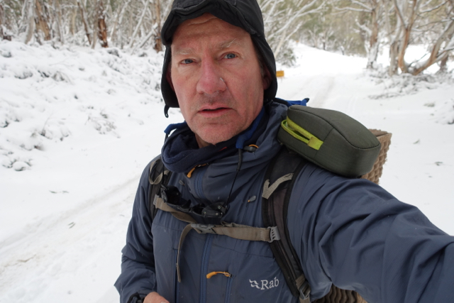
Sony RX100 MK3.  A very powerful and compact camera. 

At the end, I drove the windy road into victoria and walked the easy walk to Keeble's hut... some very nice old huts, would be good to do a thru-hike in the lower alpine areas. 


Sunday, June 2, 2019

Arapiles climbing mecca in Australia 2019


Now I'm working in the grampians, I can get to Arapiles in 1.5 hrs.  
So I spent 3 weekends there.  2 weekends with a Brasilian Friend, and did some routes I have been eying for years but never got the confidence to do...
They are after all, "trad"  routes : Traditional climbing, where you need to place all your protection while you climb, and every rope length, at belay stops.  This means you need to carry "nuts" which jam into veritcal cracks,  and "cams"  which spring load open in crack vertical or horizontal .  

So I needed to buy a few extra of these, as well as renew some of my old nylon straps which were getting pretty old.  This and a good climbing partner (Fred)  helped me get up.  And I found I had less fall anxiety than in previous years.  A lot of climbing is not physical ,but mental.  Something you could do easily off a gym mat becomes scary when you are several stories of the ground.  So you need self talk, and breaking things down into small bites. 

we did two 100m  routes, grade 9  :   "Arachnes"  and "The Eighth"
About 3 hours climbing + descent time, with 4 belays approx.  
It also helps that I have a very smooth , light and tough rope: the Beal opera superdry, 60m.   I climb with 2 strands to reduce rope drag . And these can be tied together for abseils to make a 60m  abseil.  This a good rope for multi-pitch rock, and also Ice climbing and mountaineering.   At 48g/m  the lightest on the market. 

we climbed mid may,  cool breezes and sunshine - perfect weather. 


Monday, July 30, 2018

Kosciuszko Dreaming


Van Nat park Campsite at Island Bend, 1300m


Guthega Trig Base camp


Sunset from base camp Guthega Trig.


Click on the pic above to get a slideshow.

Big screen by clicking bottom right square. Spent the winter season of 2018 in kosciuszko NP,  3 hrs south of Canberra. 
with High plateaus and ridges at 2000m altitude,  It has a large area of easy backcountry skiing/ Nordic skiing.  

Worked for a month or so In Perisher ski resort, one of the biggest in Aus along with Thredbo,  driving the shuttle buses between 2 areas in the resort.  Plenty of blizzard driving and very busy road on weekends, with cars parked on both sides of the road. 

One icy weekend on snow camping in July (minus 10 at night) , with crusty icy snow which required skins at all times.  
Then For a few weeks in September, when the snow was softer and temps more reasonable.  Culminated in 5 days snow camping at 1900m,  just below Guthega trig point, opposite Guthega resort (part of Perisher).  Which gave me many options for day touring along the 15km ridge line or  to Mt Tate etc .

Also managed to get some solo Ice bouldering in ...  just went out at night with crampons and ice axes and bouldered up the snow cornices around camp. The snow starts to freeze late afternoon as temps drop. 

This was my longest snow camp, and I was well equipped , with small solar panel to recharge my phone daily, kindle reader on my phone to read books, 4 season tent with tough and simple design (RAB Latok Mountain 2) .  Snow shovel ,  good MSR windburner stove which has a valve that adjusts gas output for altitude , cold etc. Thus giving a full burn at any altitude. 

This was vital to melt snow every day,  usually evening, to make water supplies. And fill my MSR bladder with hot water to use as a hot water bottle in my sleeping bag, then as water supply in the morning. 

I also had a recent addition - a Garmin GPSmap64s ,  which is a waterproof GPS with a screen that shows your position on a map , complete with 40m contours, peaks, roads, even small tracks marked. I turned this on whenever I went on a day trip from the tent, and it tracked my course with a thick pink line.  At any time , I could select "Trackback"  and it would guide me with a thin line showing my actual position, next to the thick one, enabling me to follow back the track I took originally.  Back to base camp. 
I used this for 2 hours or so when I a thick fog rolled in one afternoon and it was hard to see any landmarks.  It can also be used ay night. 

I also carry a PLB (Personal Locator Beacon), for emergencies.