Monday, June 17, 2013

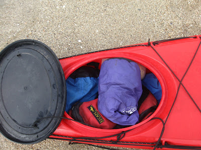
5 day solo Whitsunday Islands Kayak trip.


My itinerary ..
                                  Airlie Beach. Outrigger Regatta


Food... Nutella is especially important 


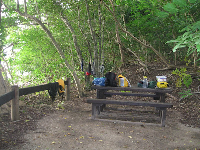
Campsite at South Molle

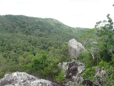
                                 View from Spion kop in South Molle island


Lady Island (East side of Whitsunday island)


                                 Campsite at Dugong Beach


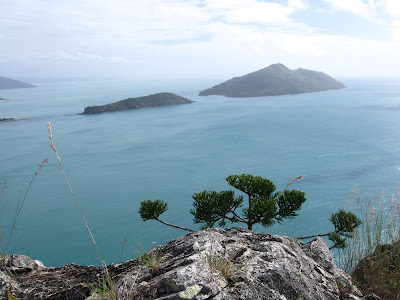
View from Whitsunday peak 430m
The Rocky beach NE whitsunday isl.

                                                           Curlew Beach, Hook island
Resting at mid-molle island


also worth looking at:
http://www.douglas.stebila.ca/blog/archives/2010/07/14/airlie-beach-and-the-whitsunday-islands/

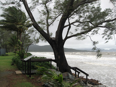
An epic 5 day trip.  Night time crossing in wind and rain to South Molle island. Used my black diamond headtorch , which I was glad to see got no salt water inside due to its IP5 rating. set up camp at 11pm and slept thru the rain. 

2 days on South Molle - did all the walks, met some backpackers at the camp, snorkeled - but murky cause it had been raining. 

South molle is lovely and accessible - as you can see in my "south molle" entry . 60$ will deposit you on the beach with jerrycans of water, to be picked up at a date you can choose - so go there and be a castaway !

day3  I crossed the Whitsunday passage, this time in easy conditions - not to hot and little wind. A few rain squalls. Then camped Dugong beach and explored the inlet , finding a tiny island called "lady island".  Day 4 Whitsunday peak - the weather was starting to calm down and I got some views.
Steep walk up thru jungle. great birds and rock wallabies in the campsite. 

330 pm  paddled north and  found a rocky beach... Spartan but got some sleep. 
day5:  paddled across in flat calm to Hook island, beautiful curlew beach. Then big crossing - 2.5 hrs to South Molle. Rested , then back to Shute Harbour. 

Following days I met some Backpackers from Chile, practiced my Spanish. They were making their way around Australia, selling nice jewelry they handmade. They sourced the semi-precious jewels themselves from India and other places. I later chatted to them at the Whitsunday markets. Quite inspiring to see such "alternative" people being relaxed and earning a living outside the mainstream. Individuals travelling and learning languages, trades as they travel is the way of the future... global nomads with internet connections. 

Then I did the Conway nat park  great walk... 30 km plus 8km of road... walking fast and jogging some of the way 9am to 5pm. Hitchhiked back to Airlie. With an Italian traveller I had met earlier... coincidences. He used to be a diving instructor in Madagascar, Honduras... and had been all around Aus in his 4wd. Check out his website:


http://onsoulwalkaboutinaustralia.blogspot.com.au/

Airlie beach has good vibes... healthy kids, smiling people... nicer and less bogan than Townsville. 

And the kayak trip got rid of a few cobwebs.. even got rid of a slightly aching hip. Just goes to show: "no guts no glory".... or "who dares wins" as the SAS likes to say. Strangely  sometimes hard physical activity can cure a sore back or whatever. I had moments of transcendence... looking at sunsets on isolated beaches,     
being greeted by strange loud birds on Dugong beach. No whales this time, tho they have been here since July 6.  I also found I could eat relatively little and not feel hungry. Civilization makes us soft and lazy... if we spend to much time in it. 

But I am not naive... the forest on Whitsunday island has it's dangers - Kudos to the early settlers who cleared some of the wilderness (a sawmill on Dugong bay). Wilderness is thorny, rocky, dark, has biting spiders, ants, centipedes, infections and other things that want you Dead.... not to be underestimated. 


Sunday, June 16, 2013

South Molle Island whitsundays, QLD


                       Scamper water taxi. 60$ return


                                 View south


View  from Spion kop rock

A superb island with history - a family grazed sheep then it was sold and a resort was built.
Great, easy walks. Excellent coral when the water is clear. Cheap nat park campsite. All within 15 minutes by water taxi from Shute Harbour. Or 1hr by kayak.
Very relaxing place.

BEST BUSH WALK - The ‘Spion Kop’ walk on South Molle Island is voted #1 by Australian Geographic for Queensland’s best bush walk


History of South Molle Island

Around 10,000 years ago, at the end of the last ice age, glaciers melted and the Coral Sea rose over the coastal plain, leaving only mountain-tops and ridges exposed as the rocky Whitsunday islands we see today.
The Whitsundays are the traditional home of the Ngaro Aboriginal people. Archaeological research shows that the Ngaro inhabited the Whitsundays, including South Molle island, for at least the past 9,000 years. The evidence includes stone axes and cutting tools found in a stone quarry on South Molle island, numerous fish traps (stone structures made for catching fish) throughout the Whitsundays, and cave paintings. Two Ngaro caves have been found on South Molle island, but only a handful of people in the world know the exact location.
Ngaro men were skilled navigators. European seafarers reported seeing Aboriginal people paddling from Double Cone island to South Molle island, a distance of 21km. Their canoes were made of sturdy three-piece bark capable of journeys on the open sea. The Ngaro Sea Trails are still being used as commercial routes.
Ngaro women collected vegetables, seeds and fruits, and prepared them for cooking and eating.
A great variety of tools, utensils and weapons were used for fishing, hunting, gathering plants and cooking. The most effective and simple tools were broken pieces of rock used for cutting, crushing grains and as axe heads. Other tools included animal teeth and twists of bark.
A quarry of these Aboriginal people on South Molle island can be seen when walking the Spion Kop track.

Wednesday, April 17, 2013

Airlie Beach National Park area


Top Photos: Cedar falls near Conway beach
Last photo: Conway beach 

A rainy and windy week discovering Areas around Conway Nat Park which is adjacent to Airlie Beach. Hiking and running a few hours of kayaking. Very nice area with a few wild beaches - eg Conway beach. Rather pricey campgrounds for a single camper.  Wild camping possible at Cedar falls but not near Airlie Beach thanks to a zealous council...

This is where France comes in front with municipal campgrounds run at little or no profit by the council. No fancy pools or landscaping, but that's not why I go camping...
However France does not have the 5$ per night National Park campgrounds that put you smack in the middle of a National park, USA style. 


Tuesday, April 16, 2013

Eungella Nat park Nth Qld


A steep windy road above Finch Hatton to get here. Very nice rainforest walks and creeks. Some Nat park campsites. The text above is a quote from famous naturalist John Muir who visited the area. Very true. I must say that the puritans at the Qld EPA don't encourage Tent camping by prohibiting fires... a fire when outdoors, especially after a days walk is natural and the one little bit of comfort people can have. I have to wonder how often the EPA bureaucrats actually camp in the wild.

NSW which is drier, allows campfires for tent campers in the wild, and so should QLD. Another example of how Universities melt people's brains and turn them into conformist drones for the Party and the Cominterm 5 year plan. .
A few quotes from John Muir:

Keep close to Nature's heart... and break clear away, once in awhile, and climb a mountain or spend a week in the woods. Wash your spirit clean.


from wiki:

John Muir (21 April 1838 – 24 December 1914[1]) was a Scottish-born American naturalist, author, and early advocate of preservation of wilderness in the United States. His letters, essays, and books telling of his adventures in nature, especially in the Sierra Nevada mountains of California, have been read by millions. His activism helped to preserve the Yosemite ValleySequoia National Park and other wilderness areas. The Sierra Club, which he founded, is now one of the most important conservation organizations in the United States. One of the most well-known hiking trails in the U.S., the 211-mile (340 km) John Muir Trail, was named in his honor.[


In 1903, President Theodore Roosevelt accompanied Muir on a visit to Yosemite. Muir joined Roosevelt in Oakland, California, for the train trip to Raymond. The presidential entourage then traveled by stagecoach into the park. While traveling to the park, Muir told the president about state mismanagement of the valley and rampant exploitation of the valley's resources. Even before they entered the park, he was able to convince Roosevelt that the best way to protect the valley was through federal control and management.
After entering the park and seeing the magnificent splendor of the valley, the president asked Muir to show him the real Yosemite. Muir and Roosevelt set off largely by themselves and camped in the back country. The duo talked late into the night, slept in the brisk open air of Glacier Point, and were dusted by a fresh snowfall in the morning. It was a night Roosevelt never forgot.[31]

During his career as writer and while living in the mountains, Muir continued to experience the "presence of the divine in nature," writes Holmes[7]:5 From Travels in Alaska: "Every particle of rock or water or air has God by its side leading it the way it should go; The clearest way into the Universe is through a forest wilderness; In God's wildness is the hope of the world."